
About Ottawa National Wildlife Refuge
|
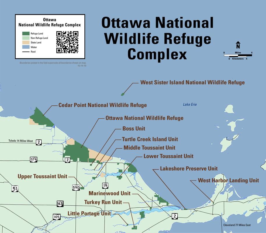
The Ottawa National Wildlife Refuge Complex lies on the southern shore of Lake Erie between the cities of Toledo and Port Clinton, Ohio. The complex consists of three refuges and two divisions. These refuges total approximately 11,000 acres and are managed by the U.S. Fish and Wildlife Service as part of the National Wildlife Refuge System. The refuge has marshes, open water, wooded wetlands, coastal wetlands, shrublands, grasslands, cropland and an estuary. The complex provides a home for a wide variety of plant and animal species as well as a critical migratory bird resting area. The refuge staff strives to maintain a diversity of habitats to support the flora and fauna reminiscent of the area's early history. |
Ottawa NWR
Ottawa National Wildlife Refuge is located approximately 15 miles east of Toledo, Ohio on the south shore of Lake Erie. It can be accessed by traveling east from Toledo on St. Rt. 2. The refuge entrance is one mile east of the junction of St. Rt. 590 and St. Rt. 2. Turn left into the refuge and follow the signs to the refuge headquarters or the hiking trails.
The Visitor Center is open Wednesday-Friday from 10am-4pm. The trails are open from dawn to dusk.
The Visitor Center is open Wednesday-Friday from 10am-4pm. The trails are open from dawn to dusk.
|
Ottawa National Wildlife Refuge consists of 8,369 acres. It is managed for waterfowl, shorebirds, neotropical migrant songbirds and other animal and plant species. In 2000 the refuge was declared an Important Bird Area by the American Bird Conservancy. In 2001 the Lake Erie Marshes, including the Ottawa National Wildlife Refuge Complex, were designated a Regional Shorebird Reserve in the Western Hemisphere Shorebird Reserve Network. In 2007 the refuge was declared an Important Bird Area by Ohio Audubon.
Ottawa National Wildlife Refuge includes nearby Darby and Navarre Divisions. The Navarre Marsh unit is about five miles east of the refuge around the Davis-Besse Nuclear Power Station. The Darby Marsh Division is located on the western edge of Port Clinton, approximately ten miles east of the refuge. Access to both divisions is by permit only. |
Take a Virtual Tour!
|
|
|
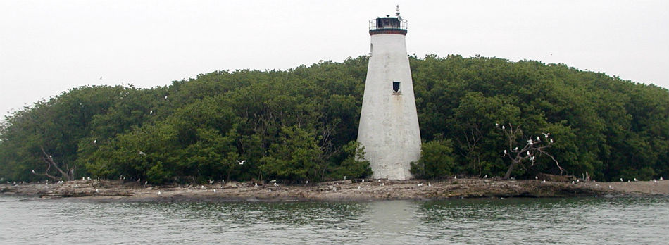
West Sister Island National Wildlife Refuge
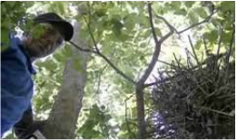
You may have heard about "Vomit Island" from popular TV series Dirty Jobs. Host Mike Rowe highlighted this protected area during a special trip with scientists to band herons. West Sister Island National Wildlife Refuge sits nine miles off shore of Ottawa National Wildlife Refuge in Lake Erie. President Franklin D. Roosevelt established West Sister Island in 1937 "as a refuge and breeding ground for migratory birds and other wildlife..." and it was specifically designated to protect the largest wading bird nesting colony on the U.S. Great Lakes. In January 1975, 77 acres of the 82 acre island were designated as a wilderness, part of the National Wilderness Preservation System. Access is by permit only. Learn more about the West Sister Island rookery here.
|
|
Cedar Point National Wildlife Refuge
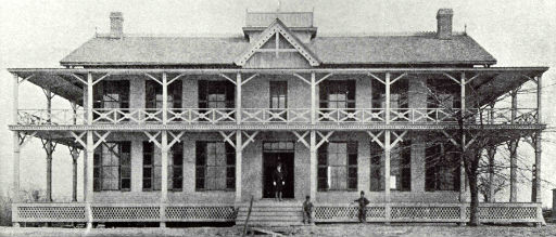
In 1964, the property at Little Cedar Point, named for the cedar trees growing on its northern tip, was donated to the U.S. Fish and Wildlife Service and became Cedar Point National Wildlife Refuge. The property included the old Cedar Point Shooting Club house, shown below. Cedar Point NWR consists of 2,675 acres, the largest contiguous marsh on Lake Erie. Access to Cedar Point NWR is by permit only.
|
|